Where do grizzly bears live today?
Grizzly bears (Ursus arctos horribilis) today occupy roughly half of their original North American range, with about 55,000 bears split across three jurisdictions: Alaska (~30,000), Canada (~20,000), and the contiguous United States (~2,000). The Lower 48 population is confined to six federally designated recovery ecosystems in Montana, Wyoming, Idaho, and Washington. Grizzlies have been extirpated from the Great Plains, California, Mexico, and most of the southwestern United States. Range contraction began with the fur trade and ended, for most of the lower states, between 1890 and 1940 through a combination of habitat conversion and deliberate extermination.
A Continent-Sized Collapse, and a Very Slow Rebuild
Two centuries ago, a grizzly bear could walk from the Alaskan coast to the Missouri River without ever leaving its own species' range. It could cross into Durango, Mexico, chase salmon through California's Central Valley, and den in the foothills of the Colorado Rockies. Lewis and Clark, travelling up the Missouri in the spring of 1805, recorded encounters with grizzlies almost daily. Estimates put the pre-contact North American grizzly population somewhere between 50,000 and 100,000 bears across roughly 5 million square kilometres.
Today, that range is a patchwork. Alaska is still full of bears. Canada is mostly full, with pressure points. The Lower 48 holds roughly 2,000 animals on islands of federal land surrounded by highways, ranches, and towns. California, which put the grizzly on its state flag, has not had a wild grizzly since 1924. Mexico, which once hosted a distinct subspecies in the Sierra Madre Occidental, lost its last confirmed bear in 1964.
This article is a full geography of the living grizzly: where it remains, why it persists there and nowhere else, and what the next fifty years of recovery and retreat are likely to look like. For the broader natural history of the species, see our profile of the grizzly bear, a North American predator.
The Historic Range: From the Arctic Coast to Durango
Before European colonisation, grizzly bears were one of the most widely distributed large carnivores on the continent. Their habitat requirements are surprisingly flexible: they need seasonal high-calorie food, denning terrain, and distance from persistent persecution. Western North America offered all three on an enormous scale.
The historic range can be summarised by four broad zones:
- Arctic and boreal: Alaska north to the Brooks Range, across the Yukon and Northwest Territories
- Cordilleran: the entire Rocky Mountain and coastal mountain chain from British Columbia to New Mexico
- Great Plains: the short-grass and mixed-grass prairie from the Canadian border to central Texas
- Sierra Madre: the high conifer forests of northern and central Mexico, south to Durango
Lewis and Clark's 1805-1806 expedition journals are one of the best pre-collapse datasets we have. Their party encountered grizzlies along the Missouri River in what are now Montana, North Dakota, and South Dakota. Thomas Say, naturalist on the Long Expedition of 1819-1820, described grizzlies on the Platte River in Nebraska. John Muir tracked grizzlies through California's Central Valley in the 1870s. Old Mexico records confirm bears in Sonora, Chihuahua, Coahuila, and Durango well into the twentieth century.
"The most striking feature of the grizzly bear's historical distribution is not its northern limit, which tracks treeline, but its eastern and southern reach. Before 1850 the grizzly was as much a plains and desert-edge animal as a mountain animal. The contraction to pure mountain habitat is entirely a product of human persecution."
- Biological Conservation, 2019
Historic versus Current Range by Jurisdiction
The table below summarises the documented collapse. "Historic" refers to verified records from Indigenous oral tradition, early exploration journals, and museum specimens. "Current" reflects 2023-2024 agency and peer-reviewed estimates.
| Jurisdiction | Historic Range | Current Status | Estimated Population |
|---|---|---|---|
| Alaska | Entire state except high Arctic islands | Stable, range intact | ~30,000 |
| Yukon Territory | Territory-wide | Stable | ~6,000 to 7,000 |
| Northwest Territories | Southern two-thirds | Stable | ~4,000 to 5,000 |
| British Columbia | Province-wide | Stable with local declines | ~15,000 |
| Alberta | Entire province | Foothills and mountains only | ~850 |
| Montana | Statewide | Two recovery zones only | ~1,100 |
| Wyoming | Statewide | Greater Yellowstone only | ~700 |
| Idaho | Statewide | Four recovery zones, thin | ~100 to 150 |
| Washington | Statewide | North Cascades only (reintroduction) | <10 |
| Oregon | Statewide | Extirpated | 0 |
| California | Most of state excluding desert | Extirpated 1924 | 0 |
| Utah | Mountain zones | Extirpated | 0 |
| Nevada | Mountain zones | Extirpated | 0 |
| Colorado | Mountain zones | Extirpated (last confirmed 1979) | 0 |
| New Mexico | Sky islands, southern Rockies | Extirpated | 0 |
| Arizona | Sky islands | Extirpated | 0 |
| Texas | Davis and Guadalupe Mountains | Extirpated | 0 |
| Great Plains states | North Dakota south to Texas | Extirpated ~1897 | 0 |
| Mexico | Sierra Madre Occidental | Extirpated ~1964 | 0 |
The pattern is clear: grizzlies retreated to high, remote, federally protected terrain, and they held their range only where a combination of low human density and strong legal protection held. Everywhere else, they were killed faster than they could reproduce.
Alaska: The Stronghold, With ~30,000 Bears
Alaska is the only place in the world where the grizzly bear occupies virtually all of its pre-contact range. The state's approximately 30,000 grizzlies are found from the southeastern panhandle to the Arctic Slope, with the highest densities along salmon-bearing river systems on the Alaska Peninsula and Kodiak archipelago.
Alaskan grizzlies split, informally and ecologically, into two body types:
- Coastal bears, which have year-round access to salmon, marine carrion, and intertidal calories. These animals are large, often exceeding 400 kg, and in the Katmai and Kodiak regions they overlap with what taxonomists classify as Kodiak brown bears. For the full coastal picture, see our brown bear profile.
- Interior bears, which rely on berries, roots, moose and caribou calves, and occasional salmon runs on tributary streams. These bears are smaller, typically 150 to 300 kg for males.
The Alaska Department of Fish and Game manages the population as a harvestable resource rather than an endangered species. Licensed hunting removes roughly 1,000 to 1,500 bears annually, and the population is considered stable or increasing in every major game management unit. There is no federal Endangered Species Act listing in Alaska and no recovery plan, because there is no recovery problem.
Canada: ~20,000 Bears Across Four Provinces and Territories
Canada holds the second-largest grizzly population on the planet, with roughly 20,000 bears distributed across British Columbia, the Yukon, the Northwest Territories, and a thin sliver of western Alberta. Grizzlies once ranged east to Manitoba and south to the Saskatchewan prairie, but the prairie populations were extirpated in the same late-nineteenth-century collapse that ended the American Great Plains population.
British Columbia is the keystone jurisdiction. An estimated 15,000 grizzlies occupy the interior mountains, the coast ranges, and the Great Bear Rainforest, where salmon-fed coastal populations reach some of the highest densities in the world. The province's 2017 ban on trophy hunting, controversial at the time, has not produced a measurable population response either up or down, confirming that Canadian grizzly populations are primarily limited by habitat and human-caused mortality rather than hunting quotas.
"The grizzly bear occupies approximately 60 percent of its historic Canadian range. Where populations remain, the principal threats are habitat fragmentation from resource roads, rail and highway mortality, and conflict kills associated with attractant management failures. The species is not threatened nationally but is designated of Special Concern."
- Canadian Wildlife Service status report
Yukon and the Northwest Territories together hold another 10,000 to 12,000 bears, largely in contiguous wilderness with minimal human contact. Alberta is the outlier: the province held grizzlies across its entire area until roughly 1950, but agricultural expansion and oil and gas development have compressed the current population to fewer than 900 bears in the foothills and mountains, and Alberta officially lists the grizzly as Threatened under provincial law.
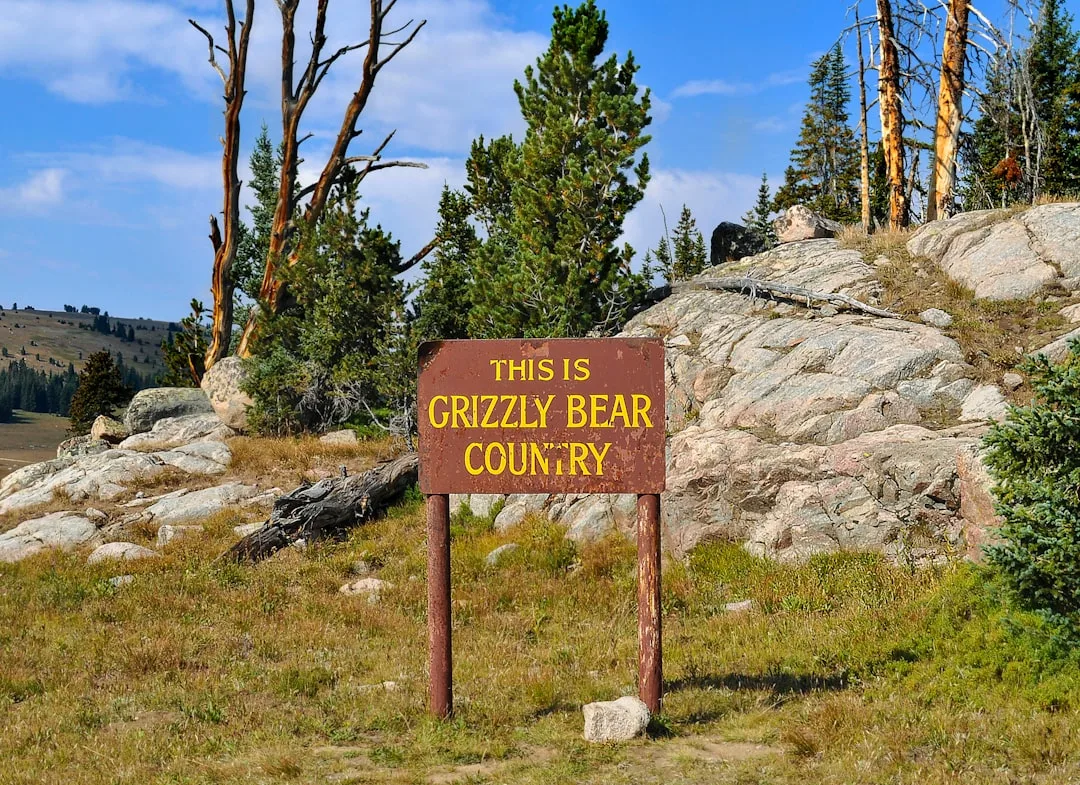
The Lower 48: Six Ecosystems, ~2,000 Bears
The contiguous United States is where grizzly recovery becomes a federal policy story. The U.S. Fish and Wildlife Service listed the grizzly as Threatened under the Endangered Species Act in 1975, when fewer than 700 bears remained south of the Canadian border. The agency designated six recovery ecosystems, each with its own population target, monitoring protocol, and conflict-management program. The Interagency Grizzly Bear Committee, formed in 1983, coordinates the work across federal, state, tribal, and provincial partners.
Lower 48 Recovery Ecosystems
| Ecosystem | States | Estimated Population (2023) | Recovery Status |
|---|---|---|---|
| Greater Yellowstone | WY, MT, ID | ~965 | Target exceeded; delisting litigated |
| Northern Continental Divide | MT | ~1,100 | Target exceeded; delisting pending |
| Cabinet-Yaak | MT, ID | ~55 to 60 | Below target; slow growth |
| Selkirk | ID, WA, BC | ~55 to 80 | Below target; cross-border |
| Bitterroot | ID, MT | <10 (active reintroduction) | Reintroduction underway |
| North Cascades | WA, BC | <10 (active reintroduction) | Reintroduction approved 2023 |
The six ecosystems together hold about 2,000 bears, or roughly 4 percent of the continental grizzly population. They occupy about 6 percent of the pre-contact Lower 48 range.
Greater Yellowstone: ~965 Bears
The Greater Yellowstone Ecosystem (GYE) covers roughly 60,000 square kilometres across northwestern Wyoming, southern Montana, and eastern Idaho. It is anchored by Yellowstone and Grand Teton National Parks and surrounded by seven national forests. Grizzlies in GYE are high-elevation, short-growing-season specialists. Their seasonal food pyramid includes whitebark pine seeds, army cutworm moths, elk, cutthroat trout, and, increasingly, meat from wolf-killed ungulates. When the 1975 listing took effect, GYE held only about 136 bears. The population crossed 600 in 2002 and 900 by 2019, and it has held roughly steady since. For what drives the diet, see what do grizzly bears eat.
Northern Continental Divide: ~1,100 Bears
The Northern Continental Divide Ecosystem (NCDE) is the largest of the six zones by area and by bear count. It includes Glacier National Park, the Bob Marshall, Great Bear, and Scapegoat wilderness complex, the Blackfeet Indian Reservation, and the Flathead Reservation. NCDE grizzlies share a border with British Columbia's Flathead population, and cross-border movement is routine. The ecosystem holds roughly 1,100 bears and is the healthiest recovery zone in the Lower 48.
Cabinet-Yaak: ~55 Bears
Cabinet-Yaak is a small, rugged mountain complex in northwestern Montana and the northern Idaho panhandle. The population crashed below 15 bears in the early 1990s and was rescued by a controversial augmentation program that translocated young females from British Columbia and NCDE. The zone now holds about 55 to 60 bears and continues to grow at roughly 2 percent per year.
Selkirk: ~55 to 80 Bears
The Selkirk Mountains straddle the Idaho, Washington, and British Columbia border. The U.S. portion holds approximately 55 bears, with an additional 25 to 30 animals routinely crossing from the Canadian side. Selkirk recovery is tightly linked to BC land-use decisions, and cross-border movement is essential to long-term genetic health.
Bitterroot: Active Reintroduction
The Bitterroot-Selway wilderness complex on the Idaho-Montana border is the single largest piece of unoccupied suitable habitat in the contiguous United States. The U.S. Fish and Wildlife Service approved a reintroduction plan in 2000, shelved it in 2001 under a change of administration, and reactivated it in 2020. As of late 2023, a handful of bears have dispersed naturally from the NCDE into the Bitterroot zone, and active translocations are under discussion.
North Cascades: Reintroduction Approved 2023
The North Cascades Ecosystem in Washington State is essentially empty of breeding grizzlies as of 2024. In April 2023 the National Park Service and U.S. Fish and Wildlife Service published a final environmental impact statement and reintroduction plan that will translocate 3 to 7 bears per year for 5 to 10 years, building to a recovery population of 200 bears over roughly a century. The North Cascades population is expected to eventually link with the British Columbia population across the international border. Related decision-making echoes the recovery framework used for polar bear populations, although the threats are entirely different.
Habitat: What Grizzlies Actually Need
A grizzly's habitat requirements are best understood as a seasonal calorie map, not a single habitat type. A bear that spends April in a riparian zone, June on a subalpine ridge, August in a berry field, and October at a salmon stream is using four distinct habitat elements in a single year, and losing any one of them degrades the entire system.
The four habitat pillars are:
- Mountain meadows and alpine zones, used from June through August for newly emergent forbs, glacier lily bulbs, biscuit-root, and army cutworm moths that aggregate on talus slopes
- Riparian zones, used year-round for cottonwood and willow calves of elk and moose, horsetail, sedges, and spring travel corridors
- Salmon streams, used from July through October on the Pacific slope, with individual bears gaining up to 40 percent of their annual calories in this window
- Berry slopes, used from late July through September, particularly for huckleberry, buffaloberry, and serviceberry, and critical for pre-denning hyperphagia
Denning habitat is a fifth pillar. Grizzlies dig dens on north- and east-facing slopes at elevations where snow arrives early and persists. Disturbance in denning terrain is the single largest indirect cause of cub mortality.
"Grizzly bears are habitat generalists within a seasonal framework. Recovery planning that focuses on a single land cover type, such as 'wilderness' or 'roadless area', misses the essential point: the bear needs a connected sequence of calorie sources across a year, and severing any link in that sequence reduces reproductive output."
- Interagency Grizzly Bear Committee
Why Grizzlies Left the Great Plains
The disappearance of the grizzly from the Great Plains between roughly 1870 and 1900 is one of the most dramatic range collapses of any large mammal in recorded history. Three forces combined:
Collapse of the bison. Commercial hide-hunting drove the North American bison from roughly 30 million animals in 1800 to fewer than 1,000 by 1884. Plains grizzlies depended heavily on winter-killed and hunter-killed bison carcasses. Without bison, the plains food base evaporated.
Industrial agriculture. The sod-busting boom that followed the Homestead Act of 1862 converted tens of millions of hectares of tall-grass and mixed-grass prairie into wheat and corn. Riparian cottonwood galleries, the grizzly's summer refuge, were cut for fuel and fence rail.
Systematic extermination. State and federal bounty systems paid ranchers and trappers by the hide. Strychnine bait, introduced in the 1870s, killed bears, wolves, and coyotes indiscriminately. Repeating rifles, widely available after 1870, made solo bear-hunting survivable for the first time in history.
The last confirmed Great Plains grizzly was killed in North Dakota around 1897. The species vanished from Kansas by 1875, Nebraska by 1885, and the Dakotas by 1900. No serious proposal to restore grizzlies to the Great Plains exists today, because the contiguous habitat necessary to support breeding bears no longer exists there. Restoration discussions focus exclusively on the western mountain ecosystems.
California and Mexico: The Southern Extirpations
California's relationship with the grizzly is uniquely painful. The bear appears on the state flag, adopted in 1911. The last verified wild California grizzly was shot in Tulare County in August 1922, and the last credible sighting was in 1924 in Sequoia National Park. Pre-contact California may have held 10,000 grizzlies, one of the densest populations on the continent, sustained by salmon, acorns, elk, tule elk, and the mild Mediterranean climate.
Mexico lost its grizzly population even later. The Mexican grizzly (Ursus arctos nelsoni) was a small-bodied subspecies restricted to the conifer forests of the Sierra Madre Occidental. By 1930 the population was already critically low, limited to a few hundred bears. Poisoning campaigns sponsored by ranchers in Chihuahua and Sonora finished the collapse. The last confirmed Mexican grizzly was killed around 1964 near Nacori Chico, Sonora. No confirmed records exist after that date, and the subspecies is considered extinct.
These southern extirpations are often cited in current ESA delisting debates. Proponents of delisting argue that the Lower 48 population has reached or exceeded recovery targets. Opponents argue that recovery should be measured against historic range, not against minimum viability, and that a species missing from 95 percent of its Lower 48 range should not be called recovered. For context on size and behaviour that shape these debates, see how big are grizzly bears and the discussion in grizzly bear vs black bear.
The ESA and the Delisting Debate
The grizzly was listed as Threatened under the Endangered Species Act in 1975. The U.S. Fish and Wildlife Service has since attempted to delist the Greater Yellowstone population twice:
- In 2007, the agency removed GYE grizzlies from the list. A federal court reversed the decision in 2009 on the grounds that the agency had not adequately analysed the collapse of whitebark pine, a key food source.
- In 2017, USFWS delisted GYE again. A federal court vacated the rule in 2018, ruling that the agency had failed to consider how delisting GYE would affect other recovery zones and that the population monitoring rule had changed without explanation.
A third delisting attempt began in 2023 and remains in rulemaking as of early 2026, with litigation widely expected the moment any final rule is issued. The Northern Continental Divide Ecosystem is subject to a parallel delisting process. The core scientific question is not whether GYE and NCDE have reached numeric targets. They have. The core question is whether the two large ecosystems can remain viable in the long term without genetic and demographic connection to each other and to the Canadian population.
"Genetic isolation is the signature risk of Lower 48 grizzly recovery. Greater Yellowstone has not exchanged breeding bears with any other population in more than a century. Modelling suggests inbreeding effects will begin to appear within three to five generations without connectivity. Recovery and delisting cannot be separated from the corridor question."
- Chris Servheen, former USFWS Grizzly Bear Recovery Coordinator
Cross-Border and Inter-Ecosystem Corridors
The corridor question is where grizzly range ecology becomes landscape politics. Three corridors are considered essential:
- NCDE to GYE, crossing Interstate 90 somewhere between Missoula and Butte, Montana. This corridor is technically biologically viable but requires wildlife overpasses and highway mitigation that do not yet exist.
- NCDE to Cabinet-Yaak, crossing the Kootenai River valley. This corridor is active but thin.
- Selkirk to North Cascades to British Columbia coastal populations, crossing several major highways and the Columbia River. This is the longest corridor and the most exposed to development pressure.
Without these corridors, the Lower 48 populations will eventually fragment into demographically isolated islands, each with a ticking genetic clock. With them, the Lower 48 grizzly can function as a single metapopulation linked to the Canadian supply. For the behavioural side of corridor use, see grizzly bear cubs and family life and are grizzly bears dangerous to humans, both of which cover dispersal and conflict risk.
What the Next Fifty Years Look Like
Three trends are shaping the next half-century of grizzly geography.
Alaska will remain stable. No combination of foreseeable development, climate, or harvest policy is likely to compress the Alaskan grizzly population below 25,000 bears in the next fifty years. Coastal populations may shift in response to salmon run timing and volume, but the state-wide range will hold.
Canada will thin at the edges. British Columbia's interior populations are likely to remain stable under current management. Alberta's foothills population will continue to struggle under road density and energy development pressure, with the provincial population potentially falling to the 700 to 800 range before conservation interventions stabilise it. Yukon and Northwest Territories populations will remain healthy.
The Lower 48 will either consolidate or fragment. The next fifty years will resolve the corridor question one way or the other. If interstate and cross-border connectivity investments are made, the Lower 48 grizzly will function as a single recovering metapopulation of perhaps 3,000 to 4,000 bears by 2075. If those investments are not made, Greater Yellowstone and the smaller recovery zones will fragment further, and delisting, whenever it arrives, will be followed by state-level management decisions that individual ecosystems may not survive.
"The Lower 48 grizzly bear is not at risk of extinction. It is at risk of becoming a collection of genetic islands. The difference matters enormously for the animal, and it should matter to the public that funds its recovery."
- U.S. Fish and Wildlife Service, Grizzly Bear Recovery Plan
Further Reading
For related wildlife conservation geography, whats-your-iq.com has an essay on how spatial cognition differs across large carnivores, and fileformer.com hosts map-conversion tools useful for working with the agency shapefiles referenced in this article. The longer-form writing course at evolang.info includes a module on scientific writing that covers how to cite agency recovery plans without misrepresenting them.
The Numbers at a Glance
- Global grizzly population is about 55,000: Alaska 30,000, Canada 20,000, Lower 48 ~2,000
- Six Lower 48 recovery ecosystems: Greater Yellowstone, Northern Continental Divide, Cabinet-Yaak, Selkirk, Bitterroot, North Cascades
- Greater Yellowstone (~965) and Northern Continental Divide (~1,100) exceed numerical recovery targets
- Historic range covered 5 million square kilometres from Alaska to Durango, Mexico, and east into the Great Plains
- California extirpated 1924, Mexico 1964, Great Plains ~1897
- Endangered Species Act listed in 1975; delisting attempted 2007, 2017, 2023, all litigated
- Corridor connectivity between ecosystems is the single most important unresolved recovery question
For a full natural-history companion to this geography, return to our overview of the grizzly bear as a North American predator, which covers the species from a behavioural and evolutionary angle rather than a spatial one.
References
- Mattson, D. J., and Merrill, T. (2002). Extirpations of grizzly bears in the contiguous United States, 1850-2000. Conservation Biology, 16(4), 1123-1136. https://doi.org/10.1046/j.1523-1739.2002.00414.x
- Servheen, C. (1999). The status and conservation of the bears of the world. Ursus, 11, 1-15. https://doi.org/10.2307/3873046
- Proctor, M. F., McLellan, B. N., Strobeck, C., and Barclay, R. M. R. (2005). Genetic analysis reveals demographic fragmentation of grizzly bears yielding vulnerably small populations. Proceedings of the Royal Society B, 272(1579), 2409-2416. https://doi.org/10.1098/rspb.2005.3246
- van Manen, F. T., Haroldson, M. A., and Soileau, S. C. (2019). Yellowstone grizzly bear investigations: annual report of the Interagency Grizzly Bear Study Team. USGS Open-File Report. https://doi.org/10.3133/ofr20191018
- Lamb, C. T., Ford, A. T., McLellan, B. N., Proctor, M. F., Mowat, G., Ciarniello, L., Nielsen, S. E., and Boutin, S. (2020). The ecology of human-carnivore coexistence. Proceedings of the National Academy of Sciences, 117(30), 17876-17883. https://doi.org/10.1073/pnas.1922097117
- Schwartz, C. C., Haroldson, M. A., White, G. C., Harris, R. B., Cherry, S., Keating, K. A., Moody, D., and Servheen, C. (2006). Temporal, spatial, and environmental influences on the demographics of grizzly bears in the Greater Yellowstone Ecosystem. Wildlife Monographs, 161(1), 1-68. https://doi.org/10.2193/0084-0173(2006)161[1:TSAEIO]2.0.CO;2
- Boulanger, J., and Stenhouse, G. B. (2014). The impact of roads on the demography of grizzly bears in Alberta. PLoS ONE, 9(12), e115535. https://doi.org/10.1371/journal.pone.0115535
- Peck, C. P., van Manen, F. T., Costello, C. M., Haroldson, M. A., Landenburger, L. A., Roberts, L. L., Bjornlie, D. D., and Mace, R. D. (2017). Potential paths for male-mediated gene flow to and from an isolated grizzly bear population. Ecosphere, 8(10), e01969. https://doi.org/10.1002/ecs2.1969
Frequently Asked Questions
Where do grizzly bears live in North America today?
Grizzly bears today occupy roughly half their historic North American range, with about 55,000 animals distributed unevenly across three jurisdictions. Alaska holds the largest share at approximately 30,000 bears, spread across nearly every ecoregion of the state from the southeastern panhandle to the Brooks Range. Canada holds about 20,000 grizzlies, concentrated in British Columbia, Yukon, the Northwest Territories, and extreme western Alberta. The contiguous United States, known as the Lower 48, holds only about 2,000 bears confined to six federally designated recovery ecosystems in Montana, Wyoming, Idaho, and Washington. Grizzlies have been extirpated from California, Oregon, Utah, Nevada, Colorado, New Mexico, Arizona, Texas, the Great Plains, and Mexico, where the last Mexican grizzly was killed around 1964.
What states have grizzly bears?
Four contiguous U.S. states have resident breeding populations of grizzly bears: Montana, Wyoming, Idaho, and Washington. Montana holds the largest Lower 48 population, shared between the Northern Continental Divide Ecosystem around Glacier National Park and the Greater Yellowstone Ecosystem. Wyoming shares the Greater Yellowstone population, centered on Yellowstone National Park and the Absaroka, Wind River, and Gros Ventre ranges. Idaho contains pieces of Greater Yellowstone, the Cabinet-Yaak, the Selkirk, and the Bitterroot recovery zones. Washington holds the North Cascades recovery zone, where grizzlies were formally reintroduced in 2023. Alaska, though not part of the Endangered Species Act recovery framework, is the only state where grizzly bears remain numerous and functionally unthreatened across most of their historical habitat.
Why did grizzly bears disappear from the Great Plains?
Grizzly bears vanished from the Great Plains for two intertwined reasons: industrial-scale habitat conversion and deliberate extermination. The plains grizzly, which Lewis and Clark encountered by the hundreds along the Missouri River in 1805, depended on bison carcasses, elk calves, riparian cottonwood groves, and seasonal berry crops. Between 1870 and 1900, commercial bison hunting collapsed the prairie food web, plow agriculture destroyed the riparian zones, and the federal and state bounty systems paid ranchers to shoot any grizzly on sight. Strychnine, steel traps, and repeating rifles finished the job. The last Great Plains grizzly was killed in North Dakota around 1897. Restoration to the plains is not currently proposed by any federal agency because there is no remaining contiguous habitat capable of supporting breeding bears.